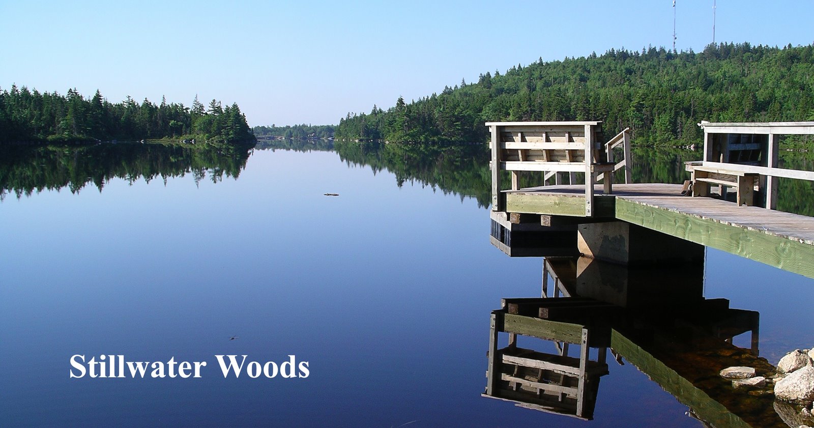
Through New
Ontario on a “Jigger”
By Richard A. Haste.
From The
Wide World Magazine 1908. Vol. xxi.—21.
Originally
published in 2 parts
Digitized
by Doug Frizzle, October 2017 for Stillwoods.Blogspot.Ca
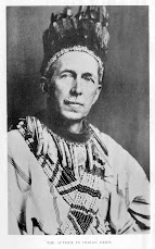
 |
| A Railway Tricycle or "Jigger" |
An account of an
unconventional trip over the new Canadian Northern Railroad, which runs for
five hundred miles through what is practically an uninhabited wilderness—a country of
magnificent lakes, mountains, and forests, and one of the finest game reserves
on the face of the earth.
NEW ONTARIO is the
name applied to that portion of King Edward’s dominions lying north and west of
Lake Superior, east of Manitoba, and south of Kewatin. It is a region of rivers
and lakes and granite hills, wild and picturesque—the haunt of moose and elk
a
nd deer. Here, too, are found the large timber wolf and the black bear; while along the creeks of the remoter forests the beaver still builds his home. The region contains workable veins of gold and silver, and is supposed to harbour vast deposits of iron ore; moreover, it is rich in historic incident, for from Lake Superior to Lake Winnipeg lay the route of the Voyageurs and the Courier des Bois of the North.
I had promised
myself a canoe trip from Grand Portage, where the international boundary line
dips into Lake Superior, to the Lake of the Woods, along the very course blazed
by these men of iron. But for one reason and another I had been unable to
fulfil the promise. So when, in the summer of 1892, I was asked to secure a
photographer and make the trip from Winnipeg to Port Arthur on a “jigger,” over
the then new line of the Canadian Northern Railroad, I readily accepted the
commission.
This was not
exactly the expedition of my dreams. The birch canoe had vanished, and in its
place stood the “jigger.” Instead of the broad lakes and winding rivers set
with rapids, there were the parallel lines of steel. And a photographer, with
tripod and camera, was to take the place of the silent Indian guide. There was,
however, one saving circumstance— the railroad line conformed, as closely as a
railroad line can conform, to the Dawson Road, and that did not depart much
from the route of the old Voyageurs.
Although the last
spike had been driven, the railroad line had not been opened to general
traffic—no regular trains were running. The five hundred miles lay mostly
through the heart of an uninhabited wilderness. I was to take a camping outfit
and do the distance by easy stages, making side excursions to points of
interest along the line as my fancy or inclination might suggest.
A “jigger,” in
railroad parlance, is a tricycle made to run on the rails when propelled by
human power. It is an innocent-looking machine, and most deceiving.
Only one jigger
being available, it was fitted with a double seat, and a tray to accommodate a
tent, a “war bag,” and the photographic outfit. Stillwell, the photographer I
had engaged, looked the affair over as it was brought from the shops, and asked
if I had had any experience with jiggers. When assured that I was as innocent
as a tadpole so far as jiggers were concerned he made no comment, but went
back to his hotel. We were to start the next morning, but in the morning he was
ill —too ill to go. I had my suspicions then, but they were not
confirmed until later. That man was not ill; he had crossed the Rockies on a
jigger, and he knew the breed. He knew that a bucking broncho can’t be more
vicious than an overloaded jigger.

Obviously the
expedition could not proceed without a photographer. I appealed to the traffic
manager.
Yes, he knew of a
first-class photographer— an artist, a man by the name of Forde, living in Port
Arthur, at the other end of the line.
“Wait a minute.” He
touched a button and the chief clerk appeared.
“Mr. Cooper, is
there a special coming West this week?”
“Yes, sir; the
general superintendent is expected here on Friday.”
“Wire Forde, Port
Arthur, to take first train and meet Mr. Haste at Warroad. Bring complete
photographic outfit.” Then, turning to me, he continued: “You can make the run
to Warroad alone. There isn’t much to photograph between here and there,
anyway.”
It was one o’clock
in the afternoon when, having loaded my camp-kit and supplies, I moved gaily
out of the yards at Winnipeg, across the bridge to St. Boniface, and struck
boldly to the south-east over twin lines of steel that led without a curve or a
break to the verge of the horizon.
I had scarcely left
the outskirts of the city, with its fringe of new-built shacks, when my
troubles began.

A strong wind was
blowing from the south. Now a jigger is as sensitive to atmospheric movements
as an unladen birch-bark canoe; but there the similarity ends. I
worked and pumped and perspired, but scarcely held my own.
Whenever I stopped for breath the thing would try and sneak back home. I urged
and coaxed it, swore internal oaths, and then got off
and led the beast with a rope. For three immortal hours I counted
the ties and cursed the fiend who invented the infernal machine.
And then the wind veered to the west. My load suddenly became light, my tow-line hung slack,
and soon the jigger was nipping at my heels. I took the hint, got aboard, and
during the next three hours reeled off thirty miles of flat prairie.
In the midst of a grassy reach I passed St. Anne, the
hithermost outpost of the Red River Settlement, calmly basking in the sun, much as it was
eighty years ago when the foundations of its solitary church were laid,
and when the chimes in the single tower broke the primeval silence of earth and
sky.
On an open plot
within a mile of the forest, that extends in an unbroken reach of two thousand
miles to the Atlantic, I made my first camp. My hands were blistered and my
muscles sore. I was a physical wreck, but I was happy. I had had my first
encounter with a jigger, and was alive to tell the story.
Supper! Was there
ever such bacon and fried potatoes? And the coffee! He who has known life and
fatigue in the wilderness will understand.
I pitched my tent,
spread my blanket, and was soon fast asleep.
At midnight or
thereabout I was awakened by a most diabolical serenade. Confused barkings, as
of a disturbed kennel of a hundred curs; staccato yelps, ending in screams of
rage like the cry of an angry child; doleful howls, long-drawn-out to a weird
wail, changing into outbursts of demoniac laughter, seemed to come from every
side. There would be absolute silence for half a minute, when a single whimper
would set the whole chorus off again.
To admit that the
hair on my neck began to creep is to admit nothing unusual under the
circumstances. I cautiously opened the flap of the tent and peered out. There,
in the light of a waning moon, sat my entertainers—coyotes. I could count only
four; there were probably as many more on the other side of the tent, but, had
I not relied on the witness of my own eyes, I should have sworn there were
forty. For full fifteen minutes I watched them at their antics; the show was
well worth the price of admission. I had no gun, and would not have used one if
I had. At last I stepped before the curtain, thanked them for the
entertainment, and bade them begone. They respected my feelings and vanished
instantly. Nor did they return, so far as I know. Later in the night I fancied
I heard a sniffing about the tent, but that may have been imagination or the
wind. The east was red when I awoke, sore and stiff, to another day. A piece of
bacon rind I had left on the outside was gone, and my frying-pan had travelled
some distance. There were no other traces of my nocturnal visitors.
Before the sun was
up I was on the road, and the click-clack, click-clack of the jigger wheels indicated
a pace of ten miles an hour. At that rate I could cover the sixty-seven miles
to Warroad with comparative ease before night. There was no wind, but I soon
began to feel the drag of an up-grade. The railroad was leaving the bed of
ancient Lake Agassiz and rising to the level of the Lake of the Woods. I had
left the great Western plains and was entering the forest that extends
unbroken from Kewatin to Labrador. Open pine “barrens,” warm in the sun, dark
swamps, dank and fragrant with moss and balsam, and ridges of upland covered
with poplar and silver birch lined the narrow lane through which I urged my now
obedient jigger.
A noonday meal with
red raspberries for desert, and a delicious rest amid the soothing silence of
an abandoned tie camp, made me forget the toil of the previous day. A leisurely
run of four hours through a tangle of sweet-smelling woods brought me to the
station at Warroad in time for supper.
Warroad is an
American village. The railroad in passing around the foot of the Lake of the Woods
is compelled to traverse some fifty miles of the State of Minnesota. The town
site is on the lake at the mouth of Warroad River, where there is a natural
harbour, recently improved by the expenditure of a forty-thousand-dollar United
States Government appropriation.
 Warroad has ambitions.
It is the only “seaport” on the American side of the Lake of the Woods. And as
Mr. Moody, the enthusiastic father of the town, assured me, it occupies the
same strategic position in regard to the Canadian North-West that Chicago does
to the north-west of the United States.
Warroad has ambitions.
It is the only “seaport” on the American side of the Lake of the Woods. And as
Mr. Moody, the enthusiastic father of the town, assured me, it occupies the
same strategic position in regard to the Canadian North-West that Chicago does
to the north-west of the United States.
The name Warroad
had its origin in a great event of Indian history.
Before the advent
of the white man the lake country of New Ontario and what is now the northern
part of Minnesota was the choice hunting-ground of the Chippewas. The woods
were full of game, the lakes were full of fish. Moreover, this favoured region
was within easy striking distance of the buffalo-covered plains of the Red
River. These hunting-grounds the Sioux—the Arabs of the Western plains—had long
coveted. With commanding strategy they planned to seize the Lake of the Woods,
it being the key to the vast interior region reached by the network of streams
and lakes of which Rainy River is the outlet.
The Chippewas,
learning of the proposed invasion, determined to force the fight on their own
ground. Selecting a position on a river that flowed into the south-west
extremity of the lake and directly across the trail which the enemy must take,
they erected fortifications and then awaited the approach of the invaders. From
this place of ambush to their base on the lake they opened up a broad road to
be used in case of retreat. The battle which ensued raged for six days. The
invaders were defeated with great slaughter. Five hundred scalps were taken,
and for ever after the Chippewas were left in peaceful possession of their
lands. The trail along the river from the lake to the battle-ground
became known as the War Trail—in English the War Road, after which the river
and the town are named.
There is a legend
of an ancient chief, not many years dead, who for
nearly a hundred years made annual pilgrimages over the War Trail from the
Indian village on the lake to the battle-ground, and there, fasting for six
days, he fought over again and again this last great battle of his people with
their fierce enemy the Sioux.
The Lake of the
Woods has a history. It has figured in more treaty stipulations and diplomatic
correspondence than any other portion of our international boundary.
It is not generally
known that long before the era of national expansion which opened with the
purchase of Alaska—in fact, from the very inception of the
original confederation, of States —the United States possessed a section of noncontiguous
territory north of the forty-ninth parallel—a territory that could be reached
only by passing over foreign soil. This territory is included in what has
become known as the North-West Angle.
In the treaty of
1873, wherein Great Britain acknowledged the independence of the United States,
it was stipulated that the northern boundary should follow the Great Lakes and
the water communications from Lake Superior to the most north-west point of the
Lake of the Woods—and thence west to the Mississippi River. This provision was
based upon the assumption that the waters from the Lake of the Woods flowed
east into Superior, and that the source of the Mississippi was north and
west of the “most north-west point” of the Lake of the Woods. This
clause, calling for at least one impossible boundary line, opened a veritable Pandora’s box of diplomatic
controversy.
The purchase of Louisiana by
extending the western boundary line of the United States to the “Stony Mountains,” and the
subsequent determination of the source of the Mississippi, simplified to some extent this
mathematical puzzle. The forty-ninth parallel was accepted as the dividing line between the
possessions of Great Britain and the United States west from the Lake of the Woods to the “Stony
Mountains.”
But
the most north-west point of the Lake of the Woods, the starting
base, was found to be about twenty-four degrees north of the agreed
parallel. To make the boundary continuous, therefore, it was necessary to
provide by treaty that from the most north-west point of the Lake of the
Woods a line drawn south to an intersection with the forty-ninth
parallel should form the connecting link. Such was the origin of the
North-West Angle.
A glance at the map
will show the international boundary line extending from the mouth of Rainy
River in a north-westerly direction across the southern lobe of the Lake of the
Woods to the head of a bay supposed to be the most north-west point of the
lake. From here a north and south line intersects the forty-ninth parallel
somewhere in the open lake about five miles from shore. This is not the end,
but the beginning of the practical complications. This line cuts off and gives
to the United States a peninsula containing one hundred and fifty square miles,
the only territory of the original domain north of the forty ninth parallel.
On my arrival at
Warroad I fell in with a corps of United States surveyors on their way to the
North-West Angle, to examine and correct the recent Government surveys of that
isolated bailiwick. They were waiting for their canoes and I was waiting for
Forde. Why not employ the interim in visiting this historical territory— this
piece of the earth’s surface that had been honoured by a distinct clause in
nearly a dozen treaties and conventions?
The first
difficulty encountered was one of transportation. There were thirty miles of
lake to cross, and the only seaworthy craft in the village belonged to a
half-breed fisherman, but his shanty was locked and his dog had not been seen
on the steps of Big Pete’s saloon since early morning. He might come back and
he might not, we were told; he was often away for days. Next morning the hut
was still locked and the dog was not sitting guard at Big Pete’s. A brisk wind
was blowing from the south-east. There was no time to lose, so we “commandeered”
the boat and in ten minutes were out of the harbour. The boat was a
thirty-foot, flat-bottomed craft with a centre-board and an abundant spread of
canvas. We hoisted every stitch, perched ourselves on the gunwale, and struck
out boldly across the “Grand Traverse.” The wind held strong, and before noon
we had rounded the eastern elbow of American territory, entered the bay, and
were at the hub of the universe—the North-West Angle. All about us was a low
swamp, with here and there low islands covered with green caps of spruce and poplar.
Here we found the ruins of an old dock, built to accommodate the line of
steamers that was to form one of the connecting links in the Dawson Road, the
first line of commercial communications between Lake Superior and the Red River
Settlement. Here also are the remains of a one-time flourishing Hudson Bay
Company’s trading post.
Why so much
diplomatic ink was spilled over a few square miles of sand ridges and
tamarack swamps, interspersed with low marshes, is explainable only when we
remember that those wily diplomats knew less of the physical features of the country
about which they were contending than they did about the canals of Mars. The
whole one hundred and fifty square miles contained within the North-West Angle
is worthless, and interesting only as a geographical curiosity.
 Fortunately for us,
the wind had changed, and under a fair breeze from the north we left the bay,
rounded the peninsula, and headed for Buffalo Point, on the south-west shore of
the lake. This point, lying mostly in Manitoba, is high and well wooded. It
figures in early history as the place where Verandrye built a fort and
established a trading post in 1732. The post was abandoned in 1763, but was
known among subsequent fur-traders as “the Old French Fort.” It is now occupied
as a reserve by the Powawasson Indians.
Fortunately for us,
the wind had changed, and under a fair breeze from the north we left the bay,
rounded the peninsula, and headed for Buffalo Point, on the south-west shore of
the lake. This point, lying mostly in Manitoba, is high and well wooded. It
figures in early history as the place where Verandrye built a fort and
established a trading post in 1732. The post was abandoned in 1763, but was
known among subsequent fur-traders as “the Old French Fort.” It is now occupied
as a reserve by the Powawasson Indians.
It was nearly
sundown when we reached Buffalo Point. I should have enjoyed a day instead of
half an hour in this historic spot; but twelve miles of wind-lashed water lay
between us and the reed-grown harbour at Warroad. We could scarcely expect to
reach it before dark—and there were no harbour lights. It was half-past nine
when, under a single fore-sail, running before the wind, we struck and threaded
the channel and tied up at the little dock. The shanty was dark—French Louis
had not returned.
I found a telegram
awaiting me, stating that the “special” would not come West until the next
Tuesday.
I had become
convinced that my jigger, in its most amiable moods, would not carry double
without protest. Fifty-four miles farther on was the town of Rainy River, a
divisional point, where I fancied it might be possible to obtain another
jigger. I concluded to make the run to that place, and intercept Forde as he
came through.
The railroad from
Warroad east to Rainy River, where it crosses into Canada, traverses a low,
level country which was once a part of the lake bed. It rises gradually to the
south, and merges into those immense muskeg swamps adjacent to the source of
the Mississippi River.
Evidences of the
homesteader were on every hand. New board shanties and line fences showed that
the American pioneer had followed the steel rails into this wilderness and
staked out his claim under the free land laws of the Government.
Although it was
scarcely seven o’clock when I started out, I passed groups of berry-pickers—
Indian women and children, shy as rabbits, but more curious. An invitation to
ride was accepted by a young squaw amid whispered protests and vigorous
pantomime on the part of the family, who no doubt took me for an up-to-date
Lochinvar seeking the hand of their fair Ellen. A half-mile spin was enough for
the young lady, who, in good English, asked to be put down. For this daughter
of the wild it was an experience—an experience that would make her the
object of special interest in her world for a day. She had been for a brief time
an integral part of the “white man’s burden.”
It was three
o’clock in the afternoon when I crossed the international bridge and
side-tracked myself at the station. Rainy River is a new town, with its streets
recently cut through the hardwood forest. Although on Canadian soil the town is
decidedly American. It is full of ambition and the smell of pine lumber. I
asked for an hotel and was directed to an unfinished building on the edge of the
woods. The rooms had been lathed but not plastered. To afford some degree of
privacy, paper had been tacked on to the laths. My request for a room with a
private bath being ignored, I took my bath in a bowl.
The Indian is much
in evidence in the vicinity of Rainy River. On the American side Baudette is in
a reservation occupied by the Chippewas, and reserves, as they are called in
Canada, occupy the choicest locations along the lakes and rivers.
The influence of
the fur-trader and the mission schools have had a marked effect upon the
Ontario Indians. They have to a large extent adopted modern dress, and many of
the young men can be found at work in the sawmills and as river-drivers. The
women, too, manage to keep step with their lords in this march toward civilized
appearances. I have seen moccasined feet peeping from beneath the folds of
velvet gowns of royal purple. On the bank of Rainy River I came upon a community
of wigwams and tepees. About an open fire crouched three old hags, filthy and
hideous. But in the door of a tepee not ten feet away stood a young
squaw—perhaps a daughter of one of the hags—doing her hair with a curling-iron.
The humour of the occasion appealed to me, and I paused to watch the process.
The dusky Juliet, as if appreciating the incongruity of the situation, gave me
a sheepish smile and hid away the implement of civilized vanity.
My first view of
Fort Francis, at the head of Rainy River, was of two white buildings against a
background of green — the Hudson Bay Company’s post (since burned), standing on
the bluff at the head of the last long reach of the river.
Fort Francis is
beautifully situated. On the east is Rainy Lake, studded with islands. Then
come two miles of beautiful water, half lake, half river, and then the falls boiling
and seething at the very feet of the town. To the west, and forty feet below
the plateau on which the town stands, is a four-mile sweep of river. To the
north for three thousand miles stretches the unsurveyed wilderness.
Immediately across
the falls from Fort Francis is the American town, Kouchiching. A more ambitious
little hamlet of five hundred souls one must go far to find—and a more wicked
one. Here, a hundred years ago, the American Fur Company, the institution that
laid the foundation of the Astor fortunes, maintained a post and competed with
the Hudson Bay factory across the river for the goodwill of the Indians and the
fur trade of the Rainy River district.
For a number of
years Kouchiching has had dreams of railroads and future greatness. The
railroad dreams are about to be realized, for within a year from this writing
two railroads —one from Duluth, another from St. Paul—are likely to have their
northern termini at this place with the romantic name—a name which the United
States Post Office has changed to International Falls. Notwithstanding the
official edict, the original name, with its barbarous grouping of vowels, still
stands and will remain.
When the “special”
at last arrived, a man with a close-cropped beard and a photographic outfit got
out of the superintendent’s private car. It was Forde, my promised
photographer. I had secured a requisition for another jigger. Armed with this
order, I confiscated one in the possession of a party of linemen, much to their
disgust.
“I don’t know how
we shall get along, but orders is orders,” was the only comment of the foreman
as he delivered over the machine.
It was 1:30 p.m.
when the “jigger special,” in two sections, was ready to move. I tried my best
to thrust upon Forde the honour of leading, but he modestly, respectfully,
though firmly declined. The reason became clear as we proceeded. My neck was
of less importance to him than his precious instruments. If one jigger was to
be sacrificed in a head end collision with a construction train or a “wild”
engine, I was to offer that sacrifice in order that the Kodaks and plates might
be saved. I regarded this view of comparative values as most uncomplimentary to
me, as well as indicating an abnormal selfishness in Forde.
(To
be concluded. End of part 1) (Link to part 2)


No comments:
Post a Comment